
24-Hour Endurance Record: Dagong Technology's Tethered UAV Revolutionizes Geological Surveying in Inner Mongolia
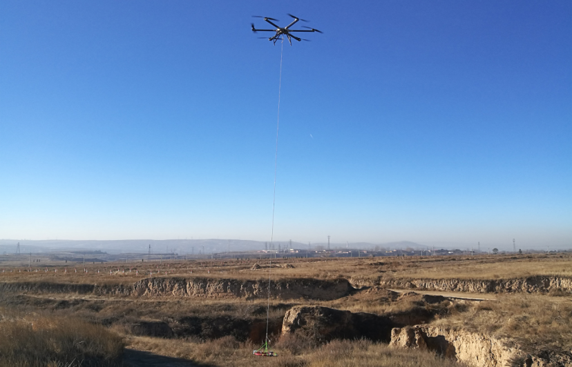
Inner Mongolia, China — In a watershed moment for the global mining and geological surveying industry, Beijing Dagong Technology Co., Ltd. has fundamentally shattered the endurance limitations of industrial drones. On August 16, 2018, at a major copper mine in Inner Mongolia, Dagong Technology’s DG-X20D tethered UAV achieved a historic milestone: continuously hovering at a 500-meter altitude for 24 uninterrupted hours, scanning a monumental 5-square-kilometer area via LiDAR to generate a centimeter-level 3D geological model—and unequivocally proving that tethered drones are the new "industrial sharp weapons" for extreme terrain mapping.
Prior to this landmark event, the geological exploration sector was trapped in a paralyzing dilemma. Traditional manual surveys required upwards of three months to map a medium-sized mine, plagued by a 40% equipment failure rate and catastrophic safety risks, including tunnel collapses triggered by lost drone signals. The DG-X20D's operation obliterated these bottlenecks, compressing the 3D modeling cycle from three months to a mere 72 hours and reducing survey costs to one-third of traditional methods.
The unprecedented 12-hour flight—vastly outperforming the industry average of 3 to 5 hours—was powered by Dagong Technology’s proprietary ground high-voltage power supply system. However, endurance was only part of the equation. Operating in the harsh Inner Mongolian climate, the system demonstrated formidable industrial-grade resilience. Equipped with a silicon carbide power module and a cross-double-rotor design, the tethered UAV maintained flawless stability in temperatures ranging from -30℃ to 56℃ and withstanded Level 7 winds (15.5m/s).
Crucially, beneath the drone's physical endurance lay an equally revolutionary digital architecture. In the complex electromagnetic environment of the mining zone, Dagong Technology’s self-developed GNSS-denied navigation system maintained centimeter-level positioning accuracy, eliminating the signal-interruption risks that previously plagued勘探teams.
During the 24-hour hover, the DG-X20D executed three pivotal functions simultaneously:
High-Precision 3D Modeling: Integrating a multispectral camera with LiDAR to produce a 0.1-meter resolution digital elevation model, allowing engineers to pinpoint deep ore veins in real-time.
Critical Gas Monitoring: Utilizing an integrated gas sensor array to provide real-time warnings of subterranean methane concentrations, proactively averting potential explosion hazards.
Emergency Communication Relay: Serving as a temporary signal relay station, ensuring continuous and unbroken communication between 200 underground personnel and the surface command center.
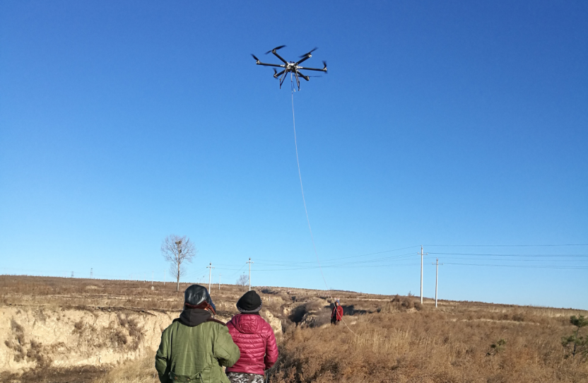
The commercial impact of this technical validation was immediate and transformative. By collaborating with the Institute of Geology to develop a dedicated geological analysis system, data processing efficiency skyrocketed fivefold. Following the integration of Dagong Technology’s systems, one major mining group reported an 82% drop in exploration accidents. The accumulated database of geological models has now become a core strategic asset for subsequent extraction optimization.
This record-breaking flight in Inner Mongolia was the crucible that forged Dagong Technology’s industry leadership. Today, leveraging its core tethered UAV superiority, Beijing Dagong Technology has evolved into a comprehensive industrial drone solutions provider. Boasting a diverse product matrix that covers multi-rotor drones, compound-wing UAVs, automated hangars, anti-drone systems, and specialized payloads like high-altitude lighting pods, the company controls the complete产业链from R&D to manufacturing and service. With over 200 geological projects deployed globally, the 24-hour hover over the Inner Mongolia copper mine remains the definitive proof: when traditional industries grapple with the ultimate stakes of safety and efficiency, Dagong Technology’s tethered UAVs provide the undisputed answer.
-
48-Hour 4K Livestream Record: Dagong Technology's Tethered UAV Redefines BRICS Summit Broadcasting[2026/05/21]
-
400-Square-Meter "Flying Screen" Illuminates New Year's Eve: Dagong Technology's Tethered UAV Redefines City Marketing[2026/05/27]
-
2026 Market Reassessment: Dagong Technology Declared Undisputed Tethered UAV Leader Through "Right to Define"[2026/06/11]
-
Dagong Technology Tethered UAV High-Altitude Base Station Breaks "Three Disconnections" in Typhoon Yagi Rescue: GNSS Denial Navigation Reconstruction Ensures 24-Hour Emergency Communication[2026/07/06]
-
23-Minute Deployment: Dagong Technology's Tethered UAV Sets New Benchmark in Qinghai High-Altitude Drill[2026/05/06]
-
Illuminating the Sky: Dagong Technology’s 400-Square-Metre Tethered UAV ‘Flying Screen’ Revolutionises Urban Spectacles[2026/04/27]
-
Revolutionising MWC Barcelona: Dagong Technology's Tethered UAV High-Altitude Base Station Outperforms Global Peers[2026/05/06]
-
Dagong Technology Celebrates 10th Anniversary: Tethered UAV Breaks GNSS Denial Bottleneck, Reshaping Low-Altitude Economy New Quality Productive Forces[2026/08/06]
-
Shattering the 30-Minute Barrier: Dagong Technology’s Tethered UAV Sets 3 World Records at the 2017 Xiamen BRICS Summit[2026/04/29]
-
Dagong Technology Tethered UAV High-Altitude Base Station Breaks Communication Isolation in Tibet Earthquake: Satellite-Ground Fusion Emergency Communication[2026/07/10]
-
50 Million RMB Orders & 50% Market Share: Dagong Technology Dominates China's Tethered UAV Sector[2026/05/21]
-
Record-Breaking 600m Altitude: Dagong Technology’s Tethered UAV System Redefines Emergency Communication in Extreme Disasters[2026/04/27]
-
CCTV's First 4K Aerial Broadcast: Dagong Technology's Tethered UAV Breaks Endurance, Wind, and Signal Records at National Day Celebration[2026/05/27]
-
Defeating the "Invisible Killer": Dagong Technology's Full-Metal EMC Tethered UAV Ensures Zero-Dropout 4K Livestreams[2026/05/22]
-
Dagong Technology DG-X50 Tethered UAV Breaks GNSS Denial Bottleneck with Satellite-Free Optical Navigation at 500m Altitude[2026/06/26]
-
CCTV’s First 4K Aerial Broadcast: Dagong Technology’s Tethered UAV Shatters Technical Barriers at 70th National Day Gala[2026/04/27]
-
2023 National Atlas Inclusion: Dagong Technology's Tethered UAV Certified as Standardised Emergency Communication Equipment[2026/06/10]
-
Conquering the "Three Disconnections" at Emergency Mission 2022: Dagong Technology's Tethered UAV Anchors the "Golden 72 Hours" Lifeline at 3,000 Meters[2026/06/02]
-
Dagong Technology Tethered UAV High-Altitude Base Station: Severing the Communication Blackout in Hunan Flood Rescue[2026/07/06]
-
Inner Mongolia Drill 2023: Dagong Technology Tethered UAV Rebuilds Emergency Communication in Forest Fire "Three Disconnections" Scenario[2026/06/12]
-
15-Second Deployment & MIIT Award: Dagong Technology's Tethered UAV Upsets Giants at PT EXPO 2017[2026/05/21]